Show summary Hide summary
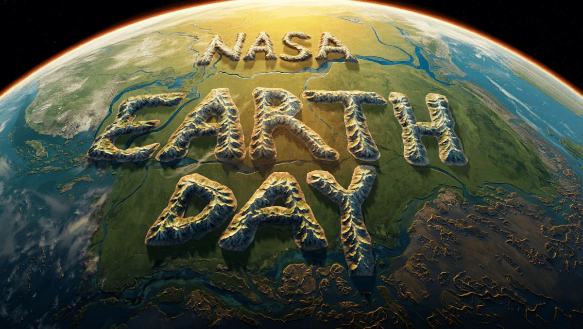
NASA just launched an interactive tool that spells your name using real satellite photos from space. The Your Name in Landsat tool lets users type any word and see it spelled out using stunning imagery of Earth’s natural landscapes. Type your name today to create a custom poster of mountains, rivers, and deserts forming your initials.
🔥 Quick Facts
- Tool Launch: Released by NASA and USGS for Earth Day 2026 celebration
- How It Works: Type any name (A-Z letters), then view name spelled in real Landsat satellite imagery
- Data Source: Images from over 50 years of Landsat Earth observation satellite records
- Free Access: Available at science.nasa.gov/specials/your-name-in-landsat/ with export options
Turn Your Name Into Stunning Space Imagery
The Your Name in Landsat tool transforms a simple text box into an interactive Earth observatory. Users enter their name letter by letter, and NASA’s system matches each character with natural formations photographed by the Landsat satellites. A river curves like the letter S. A desert plateau resembles a D. Mountains form a perfect A.
The tool celebrates how Earth’s geography creates natural letters we rarely notice from ground level. Each image comes from actual satellite data, not AI or digital rendering. The Landsat mission has been photographing our planet since 1972, creating a continuous visual record of landscapes, terrain, and environmental changes.
Jason Derulo hosts ‘Sexy For Me’ release party in Miami Beach on May 29
GMA Deals & Steals Beauty Bonanza features Laura Geller, Murad, Saint Jane
How to Create Your Custom Name Poster
Getting started takes just seconds. First, visit the NASA tool at the official Landsat website. Type your name or any word using the text box that accepts letters A through Z. The system instantly generates a custom graphic showing your name spelled in actual satellite imagery.
Users can then view and export the finished poster for sharing on social media or printing at home. The tool lets creators customize their designs and download high-resolution versions. Each letter comes with location coordinates, showing exactly which part of Earth appears in your poster. The experience connects people personally to satellite science and global geography.
Decoding Landsat, Earth’s Most Powerful Digital Camera
The Landsat program represents the world’s longest-running satellite imagery initiative. NASA and the USGS jointly manage this fleet of Earth-observing satellites that continuously monitor our planet’s climate, land use, and environmental changes. Since its launch in 1972, Landsat has captured over 50 years of continuous Earth observations from space.
| Feature | Details |
| Program Start | July 23, 1972 |
| Managing Agencies | NASA and U.S. Geological Survey |
| Coverage Record | Over 50 years of continuous imagery |
| Primary Uses | Climate tracking, land use monitoring, environmental change documentation |
“Type in your name to see it spelled out in Landsat imagery of Earth.”
— NASA Science Portal, Your Name in Landsat Official Description
Why This Tool Matters for Earth Day
The Your Name in Landsat tool launches perfectly timed for Earth Day 2026, celebrated on April 22. This year’s theme, Our Power, Our Planet, emphasizes how individual action creates global impact. The tool makes satellite science accessible to everyone, from schoolchildren to space enthusiasts. When your name appears spelled in mountains and rivers, you connect personally to Earth’s vast beauty.
NASA designed this interactive to inspire curiosity about our home planet and the technology monitoring its health. Every formation visible in the tool demonstrates real geographic features being continuously tracked by Landsat satellites for climate research, land management, and environmental protection.
Will You See Your Name Written Across the Earth?
Millions of people have already typed their names into the tool, creating personalized posters from space. Your initials could appear written by deserts, rivers, mountains, or ice fields spanning across continents. The tool’s surprising element keeps people scrolling, sharing, and exploring Earth’s natural geometry.
Have you ever wondered what your name looks like from space? Now you can find out instantly, absolutely free, using real NASA satellite data that’s been watching Earth for five decades. Visit science.nasa.gov/specials/your-name-in-landsat/ today and discover how Earth itself spells your name.
Sources
- NASA Science Portal – Official Your Name in Landsat interactive tool and documentation
- U.S. Geological Survey (USGS) – Landsat satellite program overview and mission details
- Fox40 News – NASA launches interactive Your Name in Landsat tool using Earth imagery coverage